
Adventures in Newfoundland: Fiords and Tablelands Day 8
It was just so peaceful this morning in Rocky Harbour. We slept in and then I got showered and dressed and walked over to the Treasure Box. The Treasure Box is a coffee shop and gift store. Coffee for Mark and a partridge berry muffin for me. The day looks promising – cool and sunny.
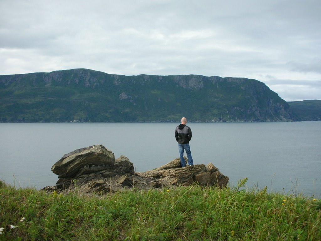
We drove to the end of town (not very far) and parked at the end of this mysterious rocky trail that led over a hill and out of sight. We later learned this was called Salmon Point. At the end of the trail was a beautiful look-out over the bay and a simple wooden pavilion and benches to further meditate the view.

On our way back into town, we stopped at a very simple building called Jackie’s Restaurant. No one else was in Jackie’s, but we both got breakfast and after taxes the bill came to $10. Not too shabby. We knew we were supposed to leave Rocky Harbour at 11:30 for our Western Brook Boat Tour. It was early, so we decided to stop at souvenir shops and look-outs along the highway as we went.
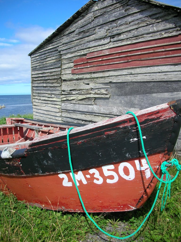
Our first stop was at Baker’s Brook. There was a tiny settlement on the beach so primitive it was hard to imagine anyone living there. There were fish-gutting tables and nets that still had seaweed drying on them, colourful wooden boats and tiny shacks with outhouses out back and curious faces peeking out at us as we walked along the rocky road. We figured that it was unlikely people lived in these little shacks all year round – maybe it was just a fishing post for certain fishing seasons.
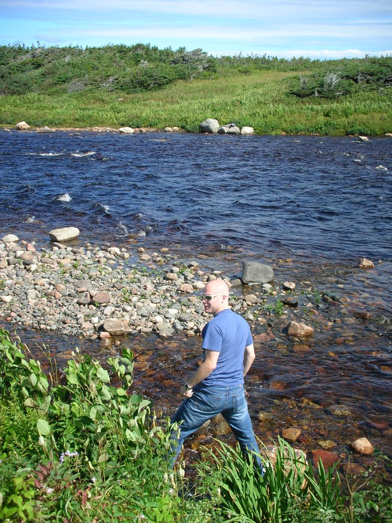
Then Mark wanted to try to hop along the rocks on Baker’s brook and he promptly plopped his foot right into the water.
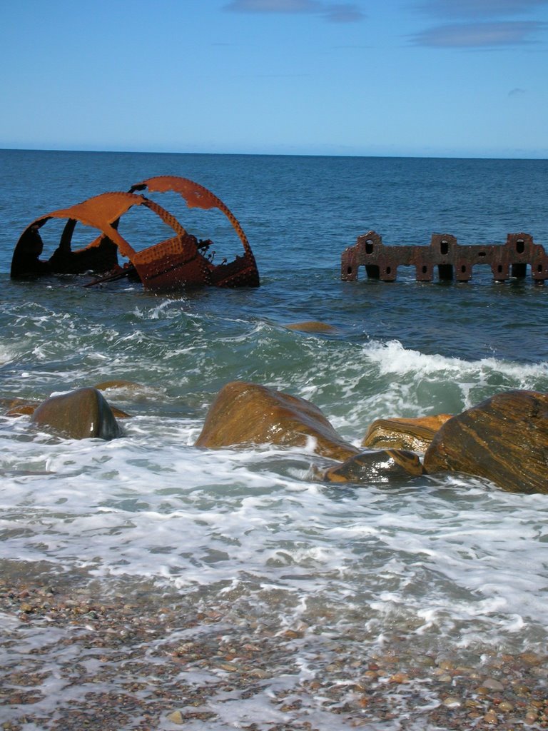
Our next stop was the beach where a ship was beached in 1914. There are still enormous metal pieces and even a hunk of wood strewn along the shore.
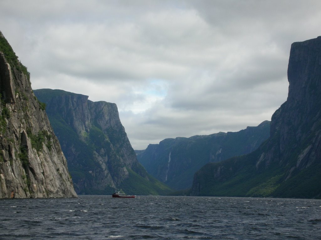
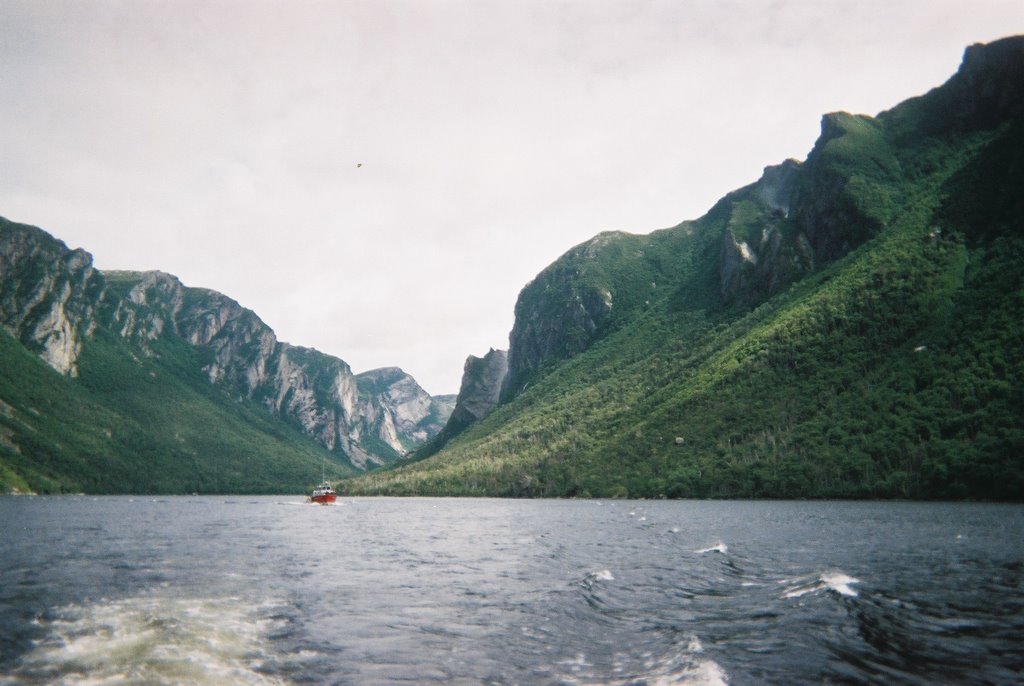
Finally we arrived at the Western Brook parking lot. It was completely full, so we had to make up our own parking spot. The 3km hike inland was flat, alternating between bog and coniferous forest. But in the distance hovered mountains cracked steeply in the middle years and years ago by glaciers during the last Ice Age. Though difficult to imagine, this pond 30m above sea level used to be part of the ocean, as evidenced by seashells and whalebones that have been excavated from its depths.
As we got on the boat, we saw, on the far shore, a tall female moose and her calf grazing peacefully. The family seated near us (a teacher from Kitchener and her husband and daughter) offered us their binoculars.
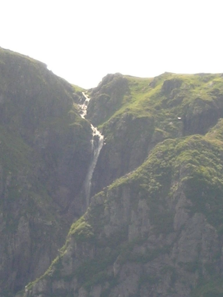
We boated past remnants of landslides, trickling water falls that seemed to disappear before they even reached the lake, and a magnificent waterfall that vapourizes into mist hundreds of feet up in the air – this one is called Pissing Mare Falls. We saw a “hanging valley” which is like a valley floor about 50m up above the lake’s surface. And we saw the shape of a lion’s head in a rocky cliff’s surface. Atop the southern ridge, there is a flat stretch of land where, every year, hundreds of caribou gather to have their young. The irony is that there are far more moose in Newfoundland than caribou, even though caribou are native and moose were introduced by people. They have, we are told, no natural predators – Newfoundland has no wolves apparently.

We got trigger-happy with the camera and then the batteries died. “Exhausted” is how the camera put it. I had taken a gravol before the tour (having learned my lesson the earlier whale-watching tour) and so I began to feel groggy. At the Visitor’s Centre, the guide told us the drive to the Tablelands was over an hour away. So, I told Mark to go ahead without me and he dropped me off at the hotel so I could nap. Today we found a book that Andrew and Shirley had recommended to us – As Near to Heaven by Sea by Kevin Majors.
* * *
Mark said the Tablelands were truly a site to be seen. We kept accidentally referring to them as the Badlands instead, but I guess they WERE kind of like badlands. As he was driving, he could see the reddish hills in the distance. Then suddenly, beside a sign for Gros Morne National Park, strategically placed, he saw a life-size moose statue….but then he realized that it wasn’t a statue at all. He had to slam on the breaks to let it cross the road – probably saving both him and the moose.
When he got to the Tablelands, he understood why people say it looks like Mars. The ground is red and there is little or no vegetation. On one side of the road, there is a mountain that is lush and green and on the other side, this red barren landscape. Apparently the theory says that two tectonic plates collided and part of one flipped upside down, exposing the underside of the Earth’s crust.

After a half hour of hiking around, he headed back to Rocky Harbour. At the spot on the highway where he’d seen the moose on his way up, he slowed down cautiously. Then he saw a baby moose dart across the road and a much larger moose on the other side of the road grazing lazily. He pulled the car over and took a nice close-up shot with the camera.

The last productive thing we did today was go to the local Groceteria to buy supplies for tomorrow’s hike up Gros Morne Mountain (all 16km of trail and 806m up and an estimated 8 hours!).
No comments:
Post a Comment